
Good brother
Esteemed Member
- Messages
- 209
- Reaction score
- 21
- Gender
- Male
- Religion
- Islam
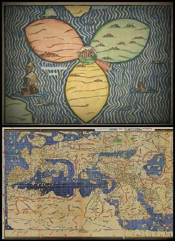
The map above was drawn by Heinrich Bünting in Germany in 1581. It's a medieval European map of the world (mappa mundi).
The map below was drawn by the Moroccan geographer Al-Idrīsī as-Sabti in 1154 at his description of the known world: "Entertainment for those wanting to discover the world "نزهة المشتاق في اختراق الآفاق ". According to modern standards, it was the best cartographical work and the richest source of geographical information produced during the Middle Ages. He was born in Ceuta, Morocco, he later moved to Palermo, Sicily when he was a distinguished guest of the Sicilian Monarch Roger II, and spent much of his working life in Sicily. After completing his studies in Córdoba, he went on to travel extensively throughout the Mediterranean.