*!* BeAuTiFul CrEaTiOnS Of ALLAH SWT *!*

  • Thread starter Thread starter Khayal
  • Start date Start date
  • Replies Replies 643
  • Views Views 124K

you always find awesome pics sis...

i like this one the best...
tornado-1.jpg

i also like the niagra falls one with the lights... makes the waterfall look amazing...
 
omg look at my pretty avatar now... remember the other one... yeah...im sick of the same avatar for a looong time... and now... here is the better one....hehehe and i will (might) post more pics... of allah's creations...
 
omg look at my pretty avatar now... remember the other one... yeah...im sick of the same avatar for a looong time... and now... here is the better one....hehehe and i will (might) post more pics... of allah's creations...

:sl:

your avatar looks cute! :) :thumbs_up

:w:
 
:sl:

your avatar looks cute! :) :thumbs_up

:w:

yes i know..so cute... i luv lookin at this stuff... i got no idea why... oh yeah some things i forgot to post...:

KATRINA IS COOOMING....

katrina1.jpg


oops... im a bit late for the warning aint i... hehe sorry...
hurricanekatrina10-1.jpg


dont blame me...i warned u
2205.canalstreet-fromtheinterstate.jpg.image

besides... why else do they got the weather channel? what u dont watch tv now..?
i still think thats pretty tho...hmp
a876_6528.jpg

stare at this next pic for a sec and tell me it aint beautiful! i dare u...
113-1.jpg


ok...now lets get away from katrina...away from america..and see something that ACTUALLY makes u feel bad...
the tsunami... poor poeple...especially indonosians... :cry:
tsunami-1.jpg


probably all these people here are dead now...
tsunami_wave_coming_now_too_late-1.jpg


and now...some random place...


ok im done making u all feel guilty and sad...for now

dArt_Tropical_Islands_vol_1_11773-1.jpg

k? k... :sl:


:sl:


.

View of Bacuit Bay from the top of the hill on Pangulasian Island, El Nido, Palawan Province
bacuitbay1.jpg

SSC photo by Laquacherra

Map of the Philippines showing El Nido north of Palawan Province
pal2-1.jpg
pal1-1.jpg

Kalayan Lake, Coron, Palawan Province
100_3127es-1.jpg

SSC photo by Wynngd

Map of the Philippines showing Coron north of Palawan Province
pal2-1.jpg

Beautiful yet dangerous Mayon Volcano in Albay Province
mayon1-1.jpg

Map of the Philippines showing Mayon in Albay Province
mayon2-1.jpg
mayon3-1.jpg

Its almost perfectly-shaped symmetric cone was formed through alternate pyroclastic and lava flows. Mayon is the most active volcano in the country, having erupted over 47 times in the past 400 years.[citation needed] It is located between the Eurasian and the Philippine Plate, at a convergent plate boundary: where a continental plate meets an oceanic plate, the lighter continental plate overrides the oceanic plate, forcing it down; magma is formed where the rock melts. Like other volcanoes located around the rim of the Pacific Ocean, Mayon is a part of the "Pacific Ring of Fire".


Wonderful Chocolate Hills in Bohol Province
boh1-1.jpg

Map of the Philippines showing Chocolate Hills in Bohol Province
boh2-1.jpg
boh3-1.jpg

The Chocolate Hills is an unusual geological formation in Bohol, Philippines. It is composed of around 1,268 perfectly cone-shaped hills of about the same size, spread over an area of more than 50 square kilometers. They are covered in green grass that turns brown during the dry season, hence the name.


Ross Ice Shelf, Antarctica.
ross1-1.jpg

Photo Credit: National Science Foundation

The Ross Ice Shelf - about the size of Spain - is the largest ice shelf of Antarctica. The nearly vertical ice front to the open sea is more than 600 km long, and between 15 and 50 meters high above the water surface. 90 percent of the floating ice, however, is below the water surface.Most of Ross Ice Shelf is located within the Ross Dependency claimed by New Zealand.

ross2-1.jpg

The Ross Dependency comprises an area of Antarctica claimed by New Zealand.
Tetiaroa Atoll, French Polynesia
tetiaroa1-1.jpg

Photo by Lance Lin


.​

:w:
 
:sl:
.

Mount Pinatubo Crater Lake, Zambales Province
pinatubo1-1.jpg

Map of the Philippines showing Zambales province
zam1-1.jpg

Mount Pinatubo is a volcano in Zambales province, Philippines. Located about 55 mi (90 km) northwest of Manila, it erupted catastrophically in June 1991 after 600 years of dormancy, killing hundreds of people and burying hundreds of square miles under volcanic ash.The eruption was one of the largest of the 20th century.

Batanes Shore
batanes7-1.jpg

Adding beauty to its interior, Batanes has small flat areas spread sporadically on its coasts with intermittent stretches of sandy beaches and rocky shorelines.


.

:w:
 
Last edited:
:sl:


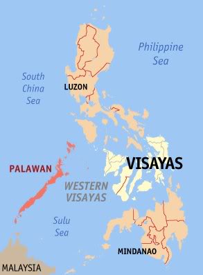
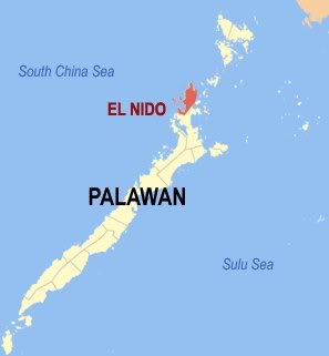
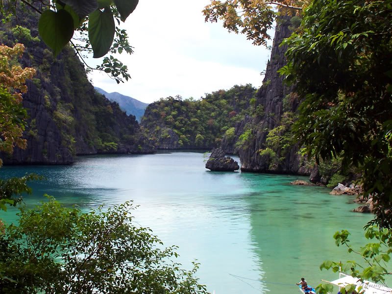
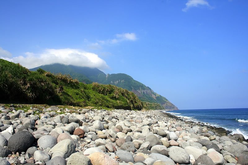
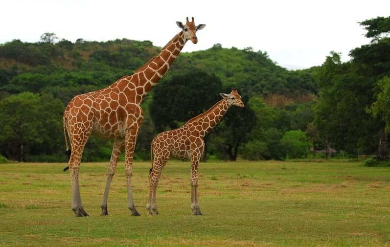
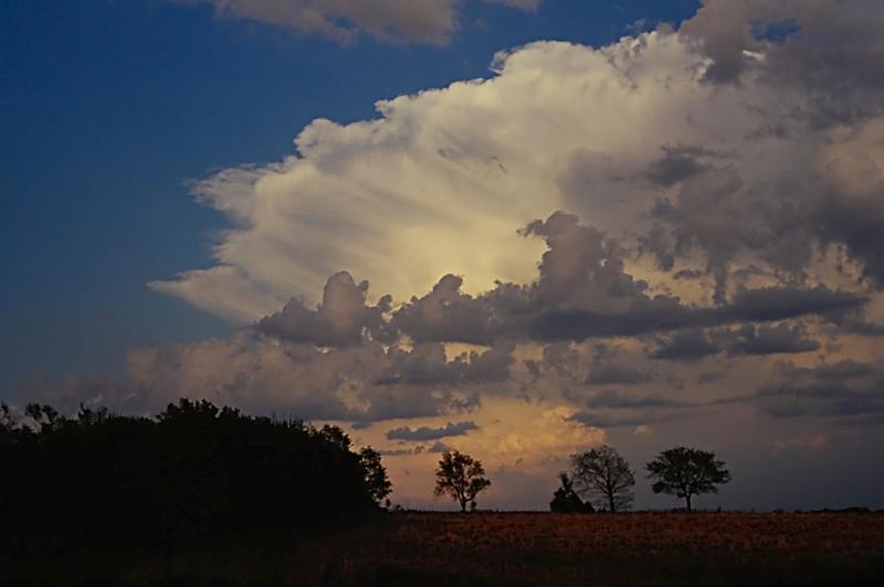
Calauit Island Game Preserve and Wildlife Sanctuary
calauit5-1.jpg

calauit6-1.jpg

Photos by Dave Deluria

Calauit one of the islands in Coron, north of Palawn Province.
pal2-1.jpg
pal4-1.jpg

The second set of Coron photos I posted, Calauit is a 3,700 hectare home for grazing giraffes, zebras, about half-dozen of antelope species and other exotic creatures roaming freely on their own island preserve. This is a sparsely occupied island within an hour's flight from Manila but a world away from the paths and byways of civilization.

1788585172_b016983ee5-1.jpg
source: flickr.com

the highest among the limestone hills of the Mantalongon Range in the town of Dalaguete in the island of Cebu, it is also reputed to be the island's highest point. From the summit, one is rewarded by views of nearby Negros Island and the much smaller resort-island of Badian.

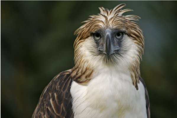
The Philippine Eagle. Photograph by Klaus Nigge for the National Geographic

303828105-1.jpg

The King of the Philippine Rain Forests.
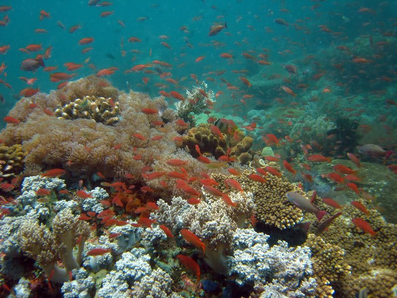
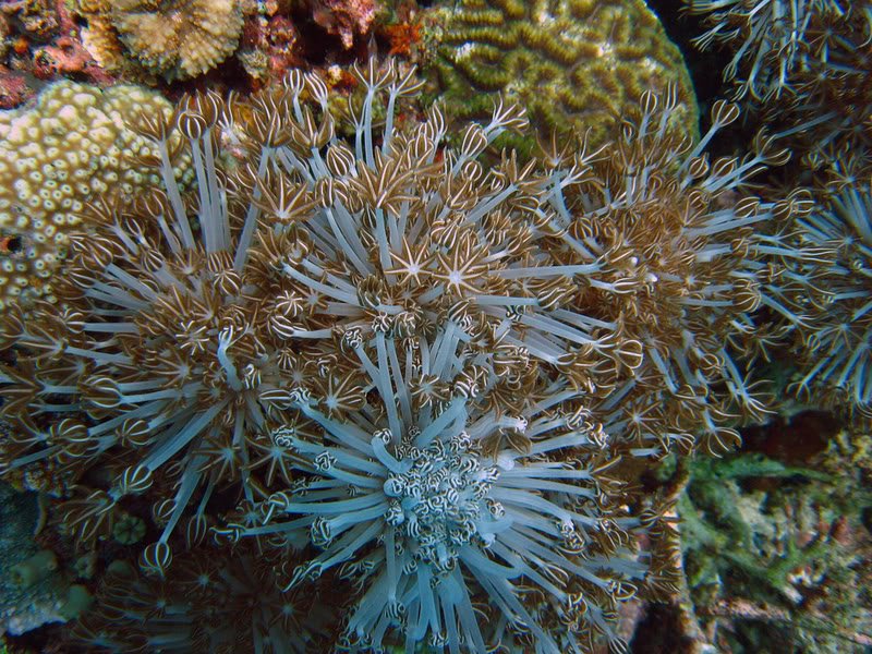

Tubbataha Reef
tubbataha2-1.jpg

Photo by Pinay Diver

tubbataha1-1.jpg

Photo by Pinay Diver

Tubbataha Reef is a marine sanctuary protected as Tubbataha Reef National Marine Park located in the Sulu Sea. Declared a World Heritage Site by UNESCO, it has become a popular site for seasoned sports divers because of its coral “walls” where the shallow coral reef abruptly ends giving way to great depths. The seemingly diverse ecosystem of this sanctuary rivals the Great Barrier Reef and many are already endangered species.

Tubbataha is home to giant jacks, hammerhead sharks, barracudas, manta rays, palm-sized moorish idols, parrot fish, moral eels, clownfish, lionfish and hawksbill sea turtles (Eretmochelys imbricata) which are endangered species.

Aside from being a marine sanctuary, Tubbataha is also renowned for being a bird sanctuary. A lighthouse islet, at the southern tip of the South Atoll, supports a large number of seabirds which nest there. Around the Tubbataha, there are tens of thousands of masked red-foot boobies, terns, and frigate birds resting during their annual migrations.

tubbataha4-1.jpg

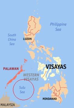
Map of the Philippines showing Tubbataha in Sulu Sea.


:w:
 
:sl:

The Great Wall
.


The Great Wall in Badaling, Beijing province


Beautiful moooooon!!!


:w:
 
:sl:
Here are some awesome images of places near me taken by a local photographer.

45711122Rain-1.jpg


665945080YOMrq4A-1.jpg


4971627120050802001a-1.jpg


5414328120050802024a-1.jpg


94691957L4XrIJeY-1.jpg


43619268P5200012-1.jpg


72210583gKyljozi-1.jpg


67748624bUxiwsau-1.jpg


The trees you can see in the distance are "Elephant Trees" situated on a big hill above the village of Frosterly ( Approx 10 min from my home... i always see them when i visit my mothers home )

5347462420050802005-1.jpg


Some more pics of the "Elephant Trees"

64886312Ol6cTrcG-1.jpg


40180314Pb100011-1.jpg

:w:
 
Last edited:
:sl:
Waterfalls in Northern England. Maybe not the biggest in the world... but still a beautiful natural creation.


Wharnley Burn waterfall, near Consett, County Durham

9906_10_9_blog-1.jpg


wharnleyburngallery_470x353.jpg


Scalehow Force, Lake District, Cumbria

896781805_19458ddc2e-1.jpg


West Burton Waterfalls, Yorkshire Dales, Yorkshire

527366332_1e34f3c103-1.jpg


Forces Falls, Lake District, Cumbria

507533862_13327653e2-1.jpg


Black Force, Howgill Fells, Cumbria

612520953_8a6fb2d92c-1.jpg


Fordingdale Force, Lake District, Cumbria

749179575_26871f7957-1.jpg


Harthope Linn, Northumberland

451394562_9d72233e74-1.jpg


High Force, Englands Biggest Waterfall, Teesdale

399pxHigh_force-1.jpg


georgecummins1-1.jpg


highforce1-1.jpg

 
:sl:


MashaAllaah! awesome pics Sis, thanks for sharing.... :)


:w:
 
:sl:


06-JUN-2006

06-JUN-2006 Dan Bush


06-JUN-2006 Dan Bush


Dan Bush


Date Unknown Dan Bush

Date Unknown Dan Bush


:w:
 

Similar Threads

Back
Top